The 21st Annual El Dia del Agua was a huge success! Our heartiest congratulations go to all the winners and to all who participated. For those who were unable to attend, you missed a fantastic day of oral and poster presentations from our graduate and undergraduate students. They were engaging, inspirational, and absolutely outstanding!
Special kudos go to this year's winners:
Melissa Schlegel, winner of the Montgomery Prize, for her oral presentation on "Constraining the timing of microbial methane generation in an organic-rich shale using noble gases, Illinois basin, USA." Melissa's $2000 award was presented by Elizabeth Leon Mora, Errol Montgomery and Associates, Inc. representative and HWR alum.
Rose McAndrew, first place winner of the Hargis Award, for best poster presentation of her work, "Groundwater contaminant transport modeling in the upper Santa Cruz basin." Rose's $1000 award was presented by Dr. David Hargis, principal of Hargis+Associates, Inc. and HWR alum.
Becky Witte, second place winner of the Hargis Award, for best poster presentation of her work, "Evaluating hydraulic responses of soils to cyclic infiltration." Becky's $400 award was also presented by Dr. David Hargis.
Ingo Heidbuechel, winner of the HWR Department Award for best oral presentation of his work, "Determination of the catchment mass transit time distribution." Ingo's $400 award was presented by Dr. Larry Winter, HWR Department Head.
Joel Biederman, winner of the HWR Department Award for best poster presentation of his work, "Changes in snowpack accumulation and ablation associated with mountain pine beetle infestation." Joel's $400 award was also presented by Dr. Larry Winter.
Dylan Cobean, winner of the Donald R. Davis Undergraduate with Distinction Award for best poster presentation of his work, "Comparison and analysis of the 2009 NASS cropland data layer to 2009 field verified crop data throughout southern Arizona." Dylan's $400 award was presented by Dr. Martha Whitaker, Undergraduate Coordinator and HWR alum.
What an outstanding group of student researchers! Congratulations again to all
the winners.
More information on this year's El Dia del Agua here.
- Content courtesy of Terrie Thompson.
Monday, April 4, 2011

Tuesday, November 23, 2010
Paul Hsieh - HWR Alum and National Hero
A national report on the response to the Macondo Well blowout and resulting oil spill was released yesterday by the Associated Press. The National Commission on the BP Deepwater Horizon Oil Spill and Response was released on Monday. Paul Hsieh a UA-HWR alum and USGS research scientist was instrumental in the decision to leave the well capped during July. Some had wanted to remove the cap but Paul's calculations based on a cell phone photo and a full night spent double checking calculations resulted in a decision to wait and see and then leave the cap on. The interim measure was key to minimizing the damage from the spill which was already the largest man caused disaster in US history.
From the AP article:
One scientist took a cell phone picture of pressure readings and e-mailed it to a government researcher in California for advice.
From the AP article:
One scientist took a cell phone picture of pressure readings and e-mailed it to a government researcher in California for advice.
Just using that cell phone photo, Paul Hsieh, a U.S. Geological Survey scientist, created a model to explain what was happening under the cap and how - despite low pressure readings - there was no leak. He was convinced the containment cap wouldn't blow. He got more data, which bolstered his case.Hsieh, a research hydrologist who normally works with water, labored through the night without the aid of caffeine. He stayed up all night triple checking calculations, going on adrenaline.
"I just knew a decision had to be made the next day," he said. "I had participated in the conference call. I had sensed the tension everyone had and that just kind of kept me going."
Hsieh laid out his case and it persuaded the other scientists to wait.
The government waited six hours, then a day. Nothing happened. The cap held.
Tuesday, November 2, 2010
International Prize for Water Awarded to Prof Marek Zareda
Please join me in congratulating Professor Marek Zreda, a Professor in the UA Department of Hydrology and Water Resources (HWR), and Dr. Darin Desilets, his ex-grad student in HWR and now of the Sandia National Laboratory, on winning the International Prize for Water, worth $266,000 (US Dollars). The announcement is at:http://psipw.org/new/index2.php?option=com_content&task=view&id=261&pop=1&page=0&Itemid=26
Friday, October 29, 2010
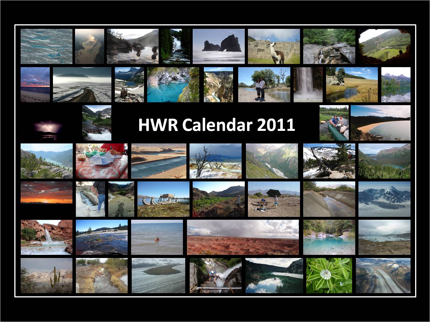
HWRSA 2011 Calendar!
Get your brand new HWRSA calendar.
Email Ingo Heidbuchel, ingohei@hwr.arizona.edu to order your calendar. If you pick up in person no extra charge if you want the calendar mailed to you it will cost $6 Shipping and Handling (USPS-prioirty - contact if overseas and Ingo will figure something out with you).


The HWR department calendars are ready to be ordered and printed!
Now you can have a look at the photos and designs and order as many calendars as you wish - be it for yourself or to give away. All the pictures were taken by our own HWR folks, so this calendar is really something special. And keep in mind, the profits go directly to the rather empty bank account of the HWR Student Association (SUDS, anyone?).
You have two options:
1. Desktop Calendar (4'' x 8''), $8 apiece
2. Wall Calendar (11'' x 8.5''), $12 apiece



Wednesday, October 27, 2010
Andrew Binley October 27th Seminar
Dr. Andrew Binley ~ Lancaster University, Environmental Science “Hydrogeophysics: Opportunities and Challenges” Wednesday, October 27, 2010, 4:00 pm Harshbarger Building ~ Room 206 Detailed knowledge on the extent, hydraulic properties, and vulnerability of groundwater reservoirs is necessary to enable sustainable use of groundwater resources. Hydrogeophysical methods can allow, for example, large scale aquifer characterisation, previously unobtainable through conventional hydrogeological techniques. In addition, time-lapse deployment of appropriate methods can give useful insight into complex subsurface processes, aiding hydrological model development and the assessment of groundwater restoration strategies. New regulatory water policies, for example the European Water Framework Directive, demonstrates the demand for new technology to assist in water resource management, with clear opportunities for hydrogeophysical method development and application. Geophysical methods have been widely used to support groundwater investigations for many years. Geophysical borehole logging is commonly used within hydrogeological studies to provide data to support the development of conceptual models of groundwater processes. Much of these established methods, however, offer only qualitative information about hydrogeological parameters and processes and during the 1990s a re-emergence of geophysics in hydrology occurred as attempts were made to provide more quantitative information about subsurface hydrology. The field hydrogeophysics emerged as a multi-disciplinary subject that focuses on the use of geophysical methods for characterising subsurface features, determining hydrogeological properties and monitoring processes relevant to soil and groundwater processes. Over the past decade hydrogeophysics emerged due to the availability of new (or developing) geophysical techniques and the potential value in addressing the hydrological challenges that had emerged from recent research. Many geophysical methods may provide solutions to the problems above but it is essential that the expectations of the hydrologist are consistent with what the geophysicist can provide. Geophysical methods will be limited in what they can offer but provided these limitations are accepted at the outset then there may be enormous potential value to a hydrological study. Imaging of hydrological structure and processes are potentially valuable hydrogeophysical tools, however, in hydrological investigations one is often faced with subtle contrasts in some geophysical property. In such cases the application of conventional geophysical inversion approaches may have limited value due to limited resolution and effects of inappropriate regularisation schemes. In addition, there is a need to link the imaged geophysical property to some useful hydrological variable or parameter. This requires reliable petrophysical models, developed at an appropriate scale. The resulting image will be subject to uncertainty, the extent of which should be understood before any hydrological value can be drawn from the image. Recent attempts have been made to tackle some of these problems. Here we outline the limitations of current hydrogeophysical methods, identify specific challenges facing the community and exciting opportunities in this field. |
Shlomo Neuman Oral HIstory Interview
Shlomo Peter Neuman is professor at the University of Arizona in Tucson. He is considered to be one of the scientists who changed the face of hydrogeology during the 20th century. In this series of 4 videos he is interviewed by Jesus Carrera, Alberto Guadagnini and Daniel Tartakovski. The interview covers some aspects of his life, his early work on well hydraulics as well as many aspects
of his research on aquifer characterization, inverse modeling, fractured media, stochastic methods, or multiscale analysis. To see this and other videos, just follow the link: http://timecapsule.ecodev.ch/
of his research on aquifer characterization, inverse modeling, fractured media, stochastic methods, or multiscale analysis. To see this and other videos, just follow the link: http://timecapsule.ecodev.ch/
Friday, October 22, 2010
Peter Troch Honored with Dalton Award from EGU
Please join me in congratulating our colleague, Dr. Peter Troch, recipient of the 2011 John Dalton Medal. This medal was established by the Division on Hydrological Sciences in recognition of the scientific achievements of John Dalton. Other prestigious award recipients can been viewed at http://www.egu.eu/egs/award6i.htm . It will be awarded by the European Geosciences Union for distinguished research in Hydrology reviewed as an Earth science.
Subscribe to:
Posts (Atom)